You are here
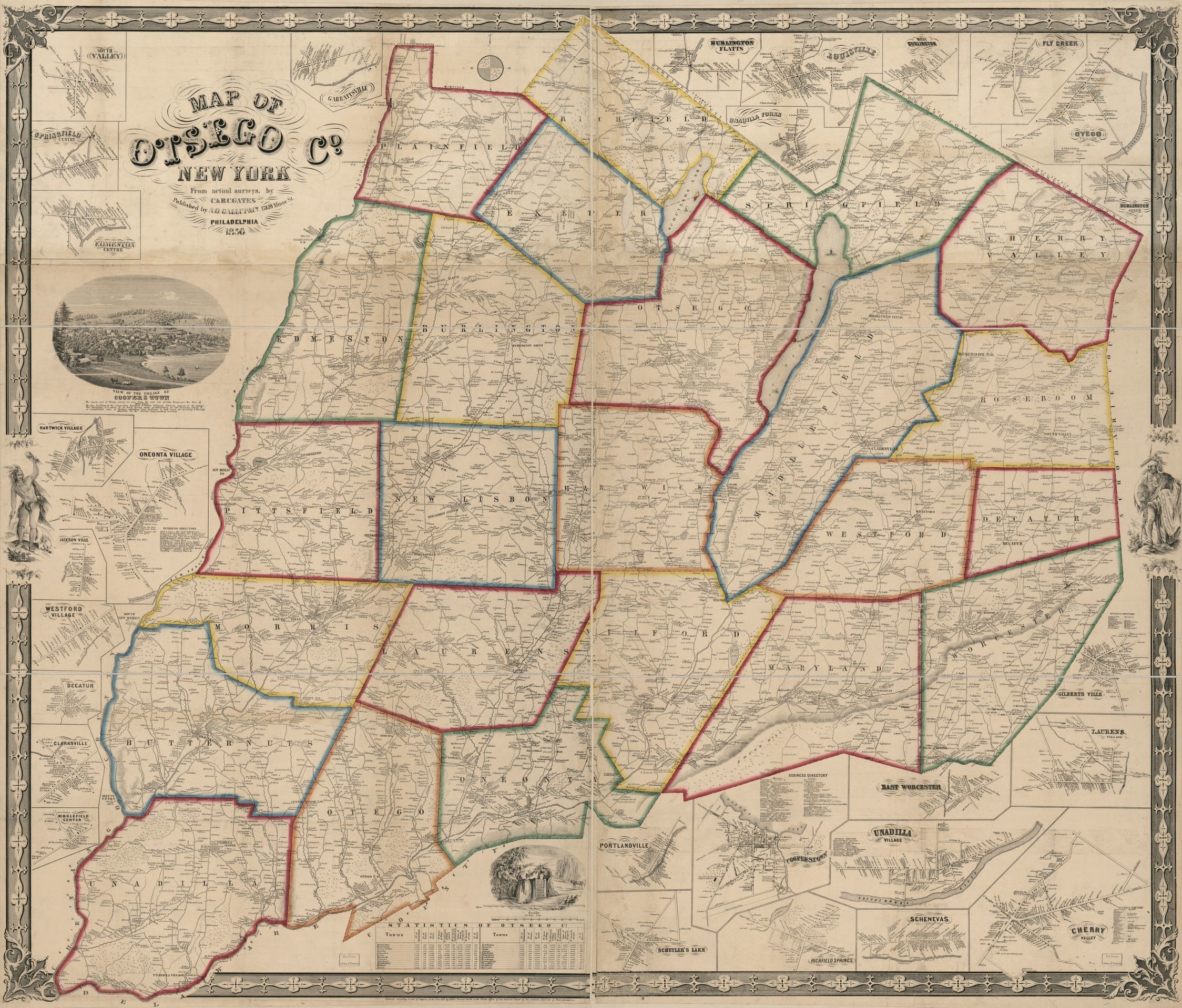
1856 Map of Otsego County

Click on link below to zoom in.
Information from Library of Congress
Title
Map of Otsego Co. New York : from actual surveys
Contributor Names
Gates, C., active 1856, cartographer.
Gates, B. C., active 1856, cartographer.
Smith, Robert Pearsall, 1827-1898, contributor.
A.O. Gallup & Co., publisher.
Created / Published
Philadelphia : Published by A.O. Gallup & Co., 17 & 19 Minor St., 1856.
Subject Headings
- Landowners--New York (State)--Otsego County--Maps
- Cities and towns--New York (State)--Otsego County--Maps
- Otsego County (N.Y.)--Maps
- United States--New York (State)--Otsego County
Genre
Maps
Notes
- Relief shown by hachures.
- General county map, showing towns and landowners' names.
- "Entered according to act of Congress in the year 1856 by Robert Pearsal Smith in the ... eastern District of Pennsylvania."
- Includes notes, 28 ancillary maps of villages and towns, statistics, business directories, and illustrations.
- LC copy sectioned into 6 and mounted on two pieces of cloth.
- LC Land ownership maps, 542
- Available also through the Library of Congress Web site as a raster image.
Medium
1 map : hand colored ; 128 x 140 cm
Call Number/Physical Location
G3803.O8 1856 .G2
G3803.O8 1856 .G2 Copy 2. Hand colored, darkened, shellacked, sectioned into 4 pieces, mounted on 2 pieces of cloth, and laminated, with some losses.
Repository
Library of Congress Geography and Map Division Washington, D.C. 20540-4650 USA dcu
Digital Id
https://hdl.loc.gov/loc.gmd/g3803o.la000542
Library of Congress Control Number
2013593259
Language
English
Online Format
image
Description
Relief shown by hachures. General county map, showing towns and landowners' names. "Entered according to act of Congress in the year 1856 by Robert Pearsal Smith in the ... eastern District of Pennsylvania." Includes notes, 28 ancillary maps of villages and towns, statistics, business directories, and illustrations. LC copy sectioned into 6 and mounted on two pieces of cloth. LC Land ownership maps, 542 Available also through the Library of Congress Web site as a raster image.
LCCN Permalink
https://lccn.loc.gov/2013593259
Additional Metadata Formats
MARCXML Record
MODS Record
Dublin Core Record
IIIF Presentation Manifest
Manifest (JSON/LD)
This site will convert jp2 to jpg
https://convertio.co/jp2-jpg/
| Attachment | Size |
|---|---|
| 3.84 MB | |
| 1.05 MB | |
| 70.05 MB |
