You are here
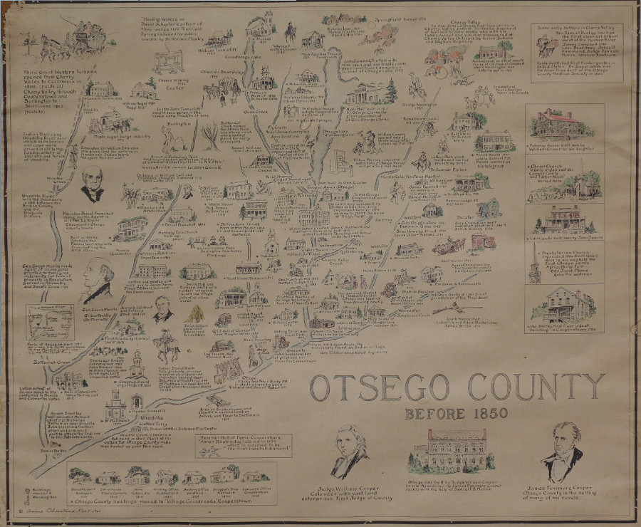
Map of Otsego County before 1850
Mary Valentine allowed me to take a photo of this map that her mother had for long time. Click on the map twice to see it in higher detail.
The map was made by Annie Olmstead Peet in 1963. The map is also in the Library of Congress at:
https://www.loc.gov/item/2013593258/
She was from Laurens, NY -
https://www.findagrave.com/memorial/44539968/annie-peet
| Attachment | Size |
|---|---|
| 225.69 KB | |
| 5.54 MB | |
| 671.35 KB | |
| 545.99 KB |

